2/70
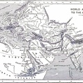
Imperial Federation-Map of the world showing the extent of the British Empire in 1886.
Statistical information furnished by Captain J.C.R. Colomb, M.P. formerly R.M.A. Mclure & Co. Queen Victoria Street, London.
British territories coloured in red. (Published as) Supplement to ''The Graphic'', July 24th, 1886. (Inset) Map of the world showing the extent of British territories in 1786.
- Author
- Under the Window
Pictures & Rhymes for Children
By Kate Greenaway
Available free from gutenberg.org - Posted on
- Sunday 29 October 2023
- Dimensions
- 1000*764
- Tags
- Albums
- Visits
- 288
- Downloads
- 27
 Download Photo


