78/561

 Download Photo
)
)
)
)
)
)


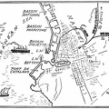
The Lower Bay has not yet been developed, but about the Upper Bay and along the Hudson and East rivers hundreds of piers are in everyday use. While New York is a huge port and while it can continue to grow for many years it has numerous disadvantages, one of the chief of which is the absence of a belt line railroad
- Author
- Ships of the seven seas
By Hawthorne Daniel
Contributor: Franklin D Roosevelt
Published 1925
Available from gutenberg.org or archive.org - Posted on
- Saturday 10 February 2024
- Dimensions
- 1000*772
- Tags
- Albums
- Technology / Transport / Water
- Visits
- 183
- Downloads
- 11