18/89
Accueil / Albums / Mot-clé Maps /

Map showing the first settlements made on the Eastern coast of North America

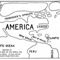
Map showing the first settlements made on the Eastern coast of North America.jpg The First printed map of EnglandMiniaturesSection of Frobisher's Map of the WorldThe First printed map of EnglandMiniaturesSection of Frobisher's Map of the WorldThe First printed map of EnglandMiniaturesSection of Frobisher's Map of the WorldThe First printed map of EnglandMiniaturesSection of Frobisher's Map of the WorldThe First printed map of EnglandMiniaturesSection of Frobisher's Map of the WorldThe First printed map of EnglandMiniaturesSection of Frobisher's Map of the WorldThe First printed map of EnglandMiniaturesSection of Frobisher's Map of the World
Google+ Twitter Facebook Tumblr

Map showing the first settlements made on the Eastern coast of North America

Auteur
The Leading Facts of American History
By David Henry Montgomery
Published in 1890
Available from books.google.com
Dimensions
934*1494
Albums
Visites
2489
Téléchargements
106